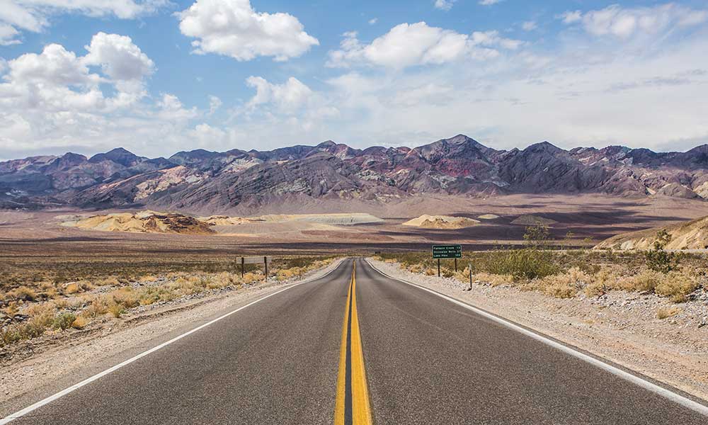
Hiking is Pennsylvania’s most popular outdoor activity. Countless trails cut through the mountains and woodlands in the area, providing travelers with various terrains to explore within 15 minutes of their homes. That said, what are some of the best hiking experiences Pennsylvania has to offer?
Hiking in Pennsylvania ranges from excursions in state parks like the Ricketts Glen Falls Loop to treks through state forests like the Shades Of Death Trail. In addition, family-friendly trips along with rail-trails, such as the Heritage Rail Trail County Park, are popular attractions.
To explore Pennsylvania’s 121 state parks, 181 rail trails, and portions of three National Scenic Trails, all you want is a map, a pair of good shoes, and a spirit of adventure. Hiking in Pennsylvania is not challenging, even though there are many forests and parks. As a result, let’s examine how hiking in Pennsylvania may enrich your hiking experience.
The Best Places To Go Hiking In Pennsylvania
There is nothing better than being in the fresh air and surrounded by nature, taking a deep breath of fresh air, feeling the warm rays of the sun on our skin, and listening to the harmony of nature.
Fortunately, Pennsylvania is a state with an abundance of hiking paths, no matter where you reside. You’ll find beginners hiking paths as well as hikes that will put your talents to the test.
Historically, Pennsylvania’s historic railways crisscrossed the state, linking the various villages that came up along the train lines and serving as essential conduits for the commodities generated by the state’s developing steel, coal, and iron industries fuelled the nation’s fast expansion.
The most extensively utilized routes were abandoned as the years passed and transportation demands evolved. As a result, there are plenty of miles of excellent level routes through some of the state’s most gorgeous places just waiting to be discovered and enjoyed by today’s Happy Travelers.
Hike, ride, ski, and explore these well-kept rail routes while admiring Pennsylvania’s natural beauty and history. In light of that, the following are some of Pennsylvania’s top hiking routes.
Mount Minsi Through The Appalachian Trail
Mount Minsi through the Appalachian Path is a moderately-trafficked 5-mile circle trail with a lake near Delaware Water Gap, Pennsylvania. This path is open all year and is primarily used for hiking, jogging, and bird watching. You can also take your dog for a walk on this route, but make sure you keep them on a leash.
Mount Minsi is a short loop that offers spectacular views of the Delaware River, Mount Tammany, and the Appalachian Mountains. This path is well-marked, well-maintained, and simple to find. There are other minor waterfalls, and on the way back, Council Rock and Lookout Rock are excellent places to stop for a rest or a picnic with a view.
The wooded mountains shade the route, and it is suggested that you wear sturdy shoes because it is rocky!
The All-Embracing Montour Trail
The Montour Trail, which runs across Allegheny and Washington counties in Pennsylvania, has been named the state’s Trail of the Year for 2017. The 63-mile recreational path is one of the United States’ longest non-motorized rail trails.
It is a lovely multi-use rail route featuring tunnels, bridges, and modest slopes. The walk is a flat, pleasant hike for people who like to take in the scenery rather than get good exercise.
The whole path, which runs from Pittsburgh to Washington, D.C. and connects to numerous other trails, is 330 miles long, although hikers utilize several portions for day excursions. The Pittsburgh airport is reached through a 6.3-mile segment.
Look for Montour Path activities, such as the Twilight Trail Walk in Canonsburg, that occasionally occur in communities connected by the trail.
The Schuylkill River Trail
There are over 130 miles of multi-use trail on the Schuylkill River Trail in Southeastern Pennsylvania, running between Philadelphia and Pottsville. About 75 miles have been completed in phases, including a 30-mile length between Philadelphia and Parker Ford.
From there, bicycles may go to Hamburg via a 20-mile marked on-road route. In addition, users may enjoy a lovely seven-mile length of the path from Hamburg to Auburn in Schuylkill County. The path is a beautiful place to relax, exercise, or commute.
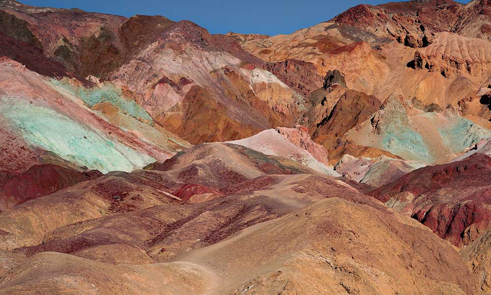
Rickets Glen Falls Loop In Rickets Glen State Park
Ricketts Glen Falls Loop in Ricketts Glen State Park is one of Pennsylvania’s top treks, and many consider it the best waterfall walk in the eastern United States.
The semi-loop through Ganoga Glen and Glen Leigh passes over 21 named waterfalls, the tallest of which is Ganoga Falls, which is 94 feet high. According to the park website, this path is rated “Most Difficult.”
Parking is available at the Evergreen Parking Area on the south side of the little picnic area or the trailhead at the bottom of the glens on the north side of Highway 118. on the north side.
If you park in the Evergreen Parking Area, get a park map from the kiosk and safely cross the highway to the Falls Trail on the west side of Kitchen Creek. If you’re beginning from the picnic area, a short connector route connects you to the main Falls Trail by crossing a bridge over Kitchen Creek.
Falls Trail follows an ancient roadbed along Kitchen Creek for the first mile, which is generally level. Throughout the trek, you’ll be in a mixed hardwood forest. Because logging was prohibited due to the steep terrain in the glens, you’ll pass through some old-growth forest along the journey.
As you gain altitude, spruce trees become increasingly frequent. Also, look for flowering dogwood trees and various wildflowers if you’re trekking in the spring, making it a unique overall experience.
The Pulpit Rock And Pinnacle Loop
This famous loop provides breathtaking views of the Lehigh Valley and adjacent peaks. This moderately challenging walk is suitable for most hikers, including some older children. However, this path, which is only an hour and a half drive from Philadelphia, may get quite congested on hot weekends, so get there early.
Although the trail is mainly moderate, a few steep portions may be challenging for particular hikers. In addition, the terrain can sometimes be somewhat rough, so sturdy footwear is required. Although the trip may be made, either way, most hikers opt for the counter-clockwise path.
The Appalachian Trail begins at the trailhead on Reservoir Road and heads northeast. Finally, pulpit Rock will be reached after a final tough climb.
The Valley Rim Trail / Appalachian Trail will take you northeast from there. You’ll arrive at The Pinnacle in no time. Continue west on the Pinnacle Trail after soaking in the sights. After there, you’ll turn left along a blue-blazed track that will take you back to the Hamburg Reservoir.
The Glen Onoko Falls And Lehigh Gorge Overlook Trail
One of the most popular paths in Lehigh Gorge State Park is the Glen Onoko Falls and Lehigh Gorge Overlook Trail. It is a risky and challenging trek that requires scrambling, but the views of the falls are spectacular.
This path is recommended for experienced hikers and may not be appropriate for a family excursion. Hiking shoes and equipment are advised. Because the journey might be complicated, bring the app or a downloadable map with you.
Hike the falls while resting by the Lehigh River. While the Glen Onoko Cascades Trail is a magnificent trek with stunning falls, there are multiple caution signs due to people who have died after falling from the top of the falls.
There are around 15 minutes of inclination on the stairs, which is an excellent cardio workout. The loop can still be completed by using the overlook trail. A short loop from the parking lot to the viewpoint to the shortcut route is also possible.
The Fernclipp Natural Area In Peninsula
The Ferncliff Peninsula trails are located in a tiny area of Ohiopyle State Park and are suitable for day hikes. Three miles of interconnecting paths are marked with black blazes. The trails are all simple to moderate hikes, ranging from the 0.1-mile Buffalo Nut Trail to the 1.7-mile Ferncliff Trail.
The peninsula as a whole has a unique environment, and because it is surrounded by water, it is home to plants found nowhere else in the region. For the best sense of your surroundings, stop by the educational Ohiopyle Visitor Center before you start hiking.
The visitor center includes thorough trail information and a topographic map of the peninsula to assist you in getting oriented before entering the 20,000-acre state park.
If you wish to trek in one of the more significant parks, such as Ohiopyle, stay for several days and base yourself at a central site, such as Nemacolin Woodlands Resort in Farmington, just a few miles away.
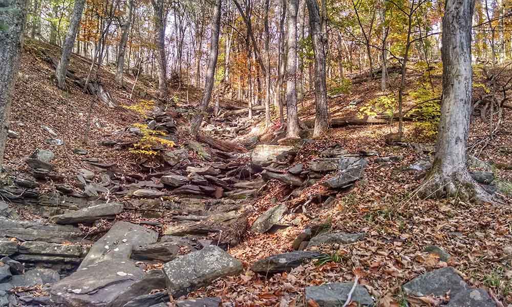
Shades Of Death Trail
In the southwestern region of the Poconos, Hickory Run State Park is home to the Shades of Death Trail. This walk is quite popular, and it, combined with Hickory Run’s Boulder Field and Hawk Falls, make this a fantastic place to visit if you enjoy being outside.
This mile-long route runs parallel to Sand Spring Run for most of its length. Sand Spring Run flows 300 feet down the slope onto Hickory Run, passing over two stunning manufactured dam waterfalls and several tiny riffles and waterfalls along the way.
Surprisingly, the park describes the Shades of Death Trail as “very challenging trekking.” Other Pennsylvania State Parks with this ranking often include challenging and steep treks up slopes. However, the grade here is based on the grim footing and a few technical sections.
There are no large uphill parts here, unlike other routes with comparable ratings. Even the tricky sections should be manageable for most hikers (if you wear proper footwear for the slippery rocks and roots). So, while the route isn’t simple, it’s also not particularly hazardous or strenuous, so don’t be put off by the difficulty level.
The Heritage Rail Trail County Park
Heritage Rail Trail County Park (HRT) is in the Rails-to-Trails Conservancy’s Hall of Fame, as is the linked Torrey C. Brown Rail Trail, which runs south into Maryland.
Both paths follow the route of the former Northern Central Railway, which ran from Harrisburg, Pennsylvania, to Baltimore, Maryland. The railway, built in the 1800s, was used to supply Northern forces traveling south during the Civil War. The road was used until 1972, when a cyclone washed away a segment.
The HRT runs from the Pennsylvania–Maryland state boundary to York, Pennsylvania. The route is open to horses and has a crushed-stone surface for the most part. During the winter, cross-country skiers and snowshoers frequent the trail.
The route runs 1.3 miles from the state border to New Freedom, the southernmost parking spot, where railroad aficionados may visit a rebuilt 1940s railway station. A train museum, an actual-size K-4 engine diorama, and an old working freight scale and safe are all available at the New Freedom station.
The Standing Stone Trail In Belleville, PA
The Standing Stone Trail is an 84-mile hiking trail that runs through Fulton, Huntingdon, and Mifflin counties. It runs from Cowans Gap State Park in the south to Rothrock State Forest’s Detweiler Natural Area and the Mid-State Trail in the north, through central Pennsylvania peaks and valleys.
It was also selected as the 2016 Trail of the Year in the state. The 1,800-mile Great Eastern Trail, which begins in Flagg Mountain, Alabama, and concludes at the Finger Lakes Trail in New York, includes the Standing Stone Trail.
The route passes through state forest and PA Game Commission game properties for more than 80% of its length. Near Mount Union, the popular Thousand Steps section of the route may be found.
Wissahickon Creek Gorge Loop Via Forbidden Drive
On this beautiful journey through Wissahickon Gorge, you may immerse yourself in a real nature experience just outside of the bustling metropolis of Philadelphia.
Following the white and orange trail on the east side of the stream and Forbidden Drive on the west, you’ll feel hundreds of miles away from the city even though it’s just about an hour’s drive away.
Listen for the plentiful birds as you stroll the creek’s banks and cross-covered bridges over the stream waters while the symphony of chickadees, blue jays, and woodpeckers resonates through the woodland.
Begin or end your journey with a snack or dessert from the Valley Green Inn, located in the heart of Fairmount Park. It’s almost too simple to spend a whole day strolling around the woods here.
Conclusion
In Pennsylvania, hiking paths range from segmented recreational rail lines to wilderness backpacking.
Hiking in Pennsylvania is appealing because of the rich woodland scenery surrounding you, with endless natural beauty on the trails, including the state flower, the mountain laurel. This list has something for everyone, from family-friendly hikes to more challenging treks with rewarding views!