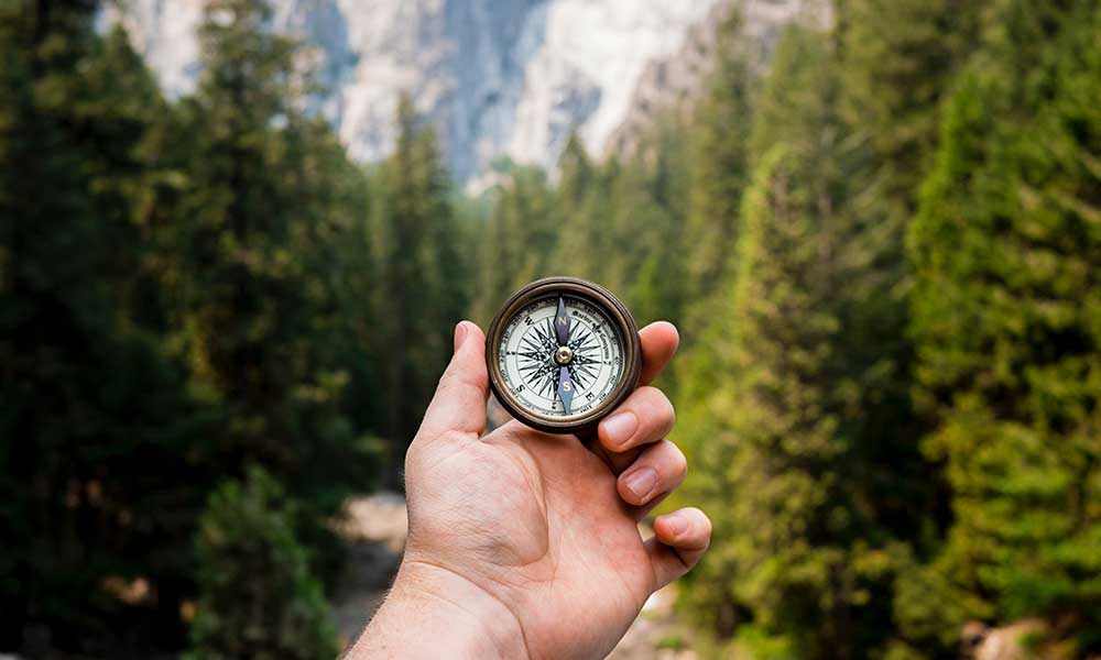
Before maps became common among all and sundry, ancient men used their natural way-finding skills for navigation. Modern technology, such as GPS devices, has made many things relatively easy. One of them is compass navigation. Using a compass alongside a map and GPS device makes it easier to find your exact location as well as your direction of travel to your destination. It’s essential to learn how to use a compass without a map or GPS system in case of unforeseen circumstances.
After setting up your compass to find magnetic north, locate a physical feature (for example, a tree) in your direction of travel as a reference point. From there, draw an imaginary line from your current location using your compass edge to your reference point. This imaginary straight line is called an azimuth line.
Navigation In Ancient Times
People have always had to navigate their way through the woods or on sea long before compasses were invented. How were ancient sailors and navigators able to find their way without the aid of compasses?
Sailors and navigators in ancient times are said to have used the position of celestial and astronomical bodies and constellations of stars to find their way. The north star, called Polaris, is located at the earth’s true north. Locating the north star helped a great deal to direct sailors, as when the north is known, one can more easily determine other cardinal points. This method, however, had limitations. It was difficult to find north when the skies were cloudy or at night.
Another technique used was the direction of the sun. It is general knowledge that the sun rises in the east and sets in the west. Knowing east helped them to figure out other cardinal points and, as a result, determine their heading.
Mapless Dead Reckoning
Mariners at sea often use this phenomenon to determine a ship’s new position by using its known initial position, speed and direction, and how long the velocity has been maintained. This method was often used by Italian explorer and navigator Christopher Columbus and some other navigators in the European Era for navigation on the sea.
Velocity was measured using a magnetic compass, while the length traveled was measured by multiplying the vessel’s speed by the time taken to arrive at its current position. Speed and distance were tracked and measured every hour using a traverse board.
How To Use A Compass Correctly Without A Map
Knowing the basics of how a compass works with a map will make it easier to use a compass without a map.
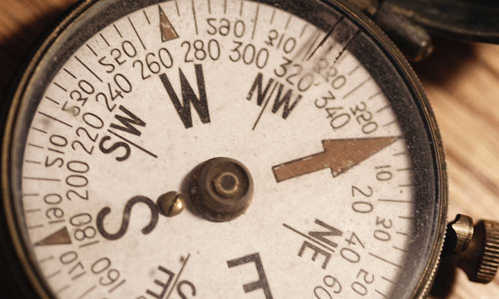
Place your baseplate compass flat on your palm. The magnetized compass needle swings and automatically points north. Remember that, to determine true north, the magnetic Declination (the difference between magnetic north on your compass and true north) of the area you’re traveling must be accounted for. Ensure you have looked up the magnetic declination of the area you’re traveling and that your information is up to date, as declination varies from time to time.
To adjust the compass for declination, rotate the compass housing or dial so that the 0° mark points north on the compass. Declination is positive if the magnetism in that area pulls your magnetic arrow towards the east and negative if the magnetic arrow is pulled in the western direction. Adjust the 0° mark to the exact number of degrees of declination the area is experiencing. For example, if the area has a variation of +10°, move the 0° mark to line up with 10° east on your compass.
Now that your compass has been calibrated properly, you can now determine the true north pole accurately. To determine your direction of travel, rotate the dial without turning the clear base plate so that the compass point (northwest, southwest, southeast, etc.) you have chosen aligns with the direction of travel arrow on the base plate.
Without turning the compass in your hand, turn around until the orienting arrow lines up under the magnetic needle’s south pole (red end). You are now facing your desired direction. With this new bearing, locate a physical feature at a distance in the same direction you’re traveling and use it as a standard or reference point that you are traveling in the right direction. Remember that your direction of travel arrow must always point away from you.
This can also be done with the aid of a floating dial (lensatic compass) which has a sighting lens that makes it easier to take accurate readings and sight distant objects simultaneously without changing eye position. As long as the magnetic needle, direction of travel arrow, and orienting arrow are in place. You’re on course and on the right path.
Fun Fact
Some animals, such as certain types of ants, fish, and birds, have a built-in sun compass to help them find direction. The African desert ant is a great example. It has the ability to travel long distances in zigzag patterns to find food and find its way back to its original position. This ant can do this due to its natural, in-built sun compass located in the eye and odometer, which is used to measure distance.
Some other animals, like pigeons, can navigate using the earth’s magnetic field. The brains of pigeons function like an internal magnetic compass to follow the earth’s magnetic field.
The human brain also possesses mental mapping abilities which are located in the hippocampus of the brain. Despite these human abilities, we’ll never be able to navigate as accurately as the African desert ant without the aid of a compass. This explains why we often experience walking in circles when trying to find our way around an area.
Other Tips And Tricks
Below are a few helpful tips and tricks that could come in handy.
Using Your Hands As A Sundial
You can use your hands as a portable sundial if you do not have a wristwatch or other timepieces to measure time. This trick would obviously only work on sunny days.
Stand facing north with your left forearm held parallel to your torso and your palm facing down with fingers curled under. Place your right index finger straight against the center back of your left hand, and the other fingers curled out of the way so that your right index finger forms a sharp 90-degree angle with the back of your left hand.
To do this easily, raise your upper arm from your right shoulder so that your elbow is clocked up and your wrist is bent down. Imagine the back of your left hand as a clock face and mentally place the clock digits in their normal positions. You can now tell the time approximately by taking note of where the shadow of your finger falls.
Protect Your Compass
To keep your compass working accurately, you must keep it away from any magnetized metal or material which is capable of demagnetizing the magnetic needle and reversing the magnetic pole of your compass.
Take Note of Magnetic Declination
As mentioned earlier, true geographic north could be several degrees away from magnetic north, depending on your location, and this varies from time to time.
Can I Get Lost Using Only A Compass As A Navigation Tool?
The simple answer to this question is yes. You can get lost if you do not pay attention to some essential things, like reshooting your azimuth line and checking if you’re on the right path at regular intervals. This is important because stride or foot length usually varies, and we tend to veer off-road in the direction of our dominant leg, which often has longer strides. It is essential to check your azimuth as often as possible, especially when journeying through uneven terrain with obstacles here and there.
Pace counts also help. They help you to keep track of distance. A pace count is where you count every time your right or left foot hits the ground. You can count the paces you must take to cover a length of 100 meters on a smooth terrain.