Rattlesnake Canyon is a location in Arizona Navajo Nation near Page, Arizona. The canyon is a large desert that is home to 18,000 acres of canyons, mesa, and desert. The Rattlesnake Canyon and other slot canyons are great for photography tours
Rattlesnake Canyon in Arizona gets its name from the snake-like shape and curves in the slot canyon. It is known for its diversity of plant life and wild animals. The area hosts many birds, coyotes, rabbits, lizards, snakes, jackrabbits, deer, wildcats, rattlesnakes, and scorpions.
There are three organizations that offer Upper Antelope guided tours:
All three provide help visitors create photo and visual tours of the canyon. You can also find a more extensive list of tours on the Arizona Office of Tourism site.
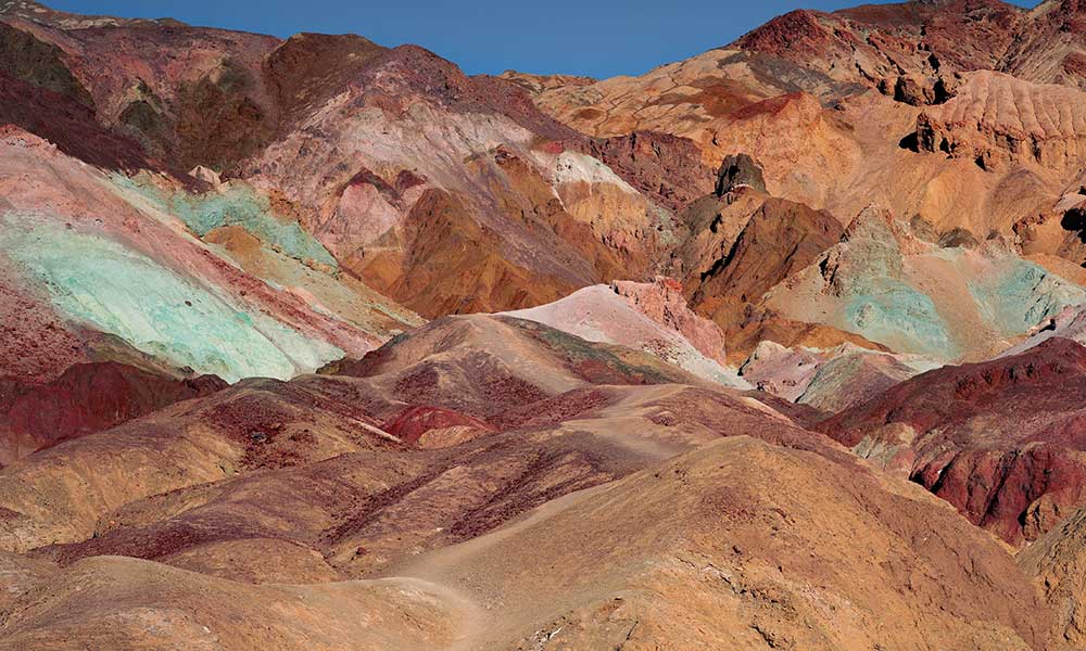
The Rattlesnake Canyons
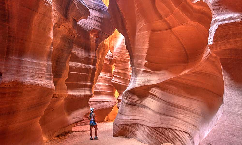
Picture of Rattlesnake Canyon ground-level shot.
While Rattlesnake Canyon gets its name from its snake-like shape and curves it is also believed that rattlesnakes are often found within the canyon but that is not the reason for the name. Some other creatures that are located there also include the great-horned owls. This great spot provides many opportunities for a quality photography tour.
This beautiful slot canyon contains not one but two arches: the first is located very close to the beginning, and the second, more attractive arch is relatively close to the end. There are a few ladders at the entrance, which are very narrow in some spots.
When purchased in conjunction with an Upper Antelope Canyon trip, Adventurous Antelope Canyon offers hikers the opportunity to go on a rattlesnake tour. Outside of the Antelope Canyons, the Rattlesnake slot canyon is one of the top picks for the best slot canyon in Page, Arizona. The topographic map of the White Dome includes coverage of Rattlesnake Canyon.
The Page Slot Canyons
The formation of Arizona slot canyons begins with the rock formations of a single fissure or crack in the earth’s rocky surface. This process takes millions of years and involves the action of a great deal of water, wind, and erosion before the result is what we now refer to as a slot canyon.
They are essentially deep, slender gorges in the soil with undulating walls and wind around in a serpentine pattern according to the direction in which the water ultimately flowed. It is impossible to find two slot canyons that are identical; each has its distinct appearance, hues, textures, and shape.
The Owl Canyon
The Arizona Owl Canyon is a deep, narrow slot canyon located in the Mogollon Rim. The canyon has a dark and ominous reputation, which lends itself to the name “Owl Canyon.”
The Owl Canyon was formed over time by erosion from the north, primarily by rainwater flowing through loose rocks and plant roots. The canyon’s walls are covered with stalactites, making it appear like a dark stone cavern.
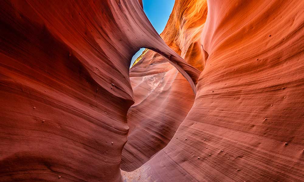
The Antelope Canyon on Navajo land east of Lechee, Arizona
Picture of Upper Antelope Canyon, AZ.
Both the Upper Antelope Canyon and the Lower Antelope Canyon are breathtaking, but the Upper Antelope Canyon is the one that is typically depicted in photographs of Antelope Canyon. If you want pictures of the light beams, the best time to go to the Upper canyon is during the middle of the day, specifically between 10:30 and 1 pm.
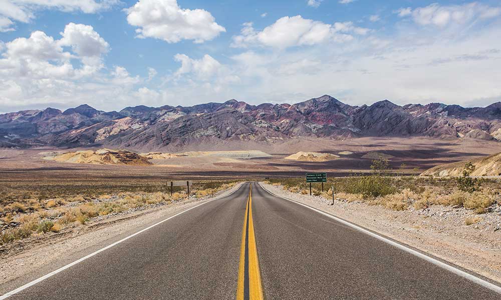
To reach either canyon from Page, Arizona, take 89 local (Lake Powell Boulevard) to Coppermine Road, continue down the road until you reach Highway 98, and turn left onto Highway 98. Follow Route 98 for approximately 2.5 miles until you see a sign pointing right into Upper Antelope Canyon. Turning left on Route 222 immediately after passing the sign for Upper Antelope Canyon will bring you to Lower Antelope Canyon.
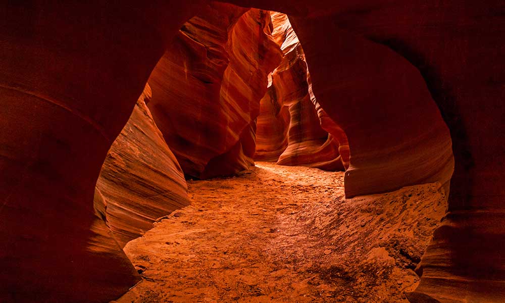
Upper Antelope Canyon
Why Upper Antelope Canyon tours? Upper Antelope Canyon has the appearance of an inverted “V,” with a narrow rim at the top and a broad floor at the bottom. Because the bottom of this canyon is wider than the bottom of Lower Antelope Canyon, it is easier to go through and provides a less claustrophobic experience.
The Upper canyon receives the most attention. These light beams are reasonably well-known and are captured frequently on camera. No hike is involved, as the entire route is flat and only requires a short walk. Explore responsibly.
When the sun is at the correct position, it creates light beams due to the narrow canyon walls at the top. The Upper canyon is made darker and feels cooler due to the canyon walls’ height and narrowness.
The Lower Antelope Canyon
Lower Antelope Canyon has a “V” shape. Because it is pretty tight at the bottom and relatively open at the top, the Lower Canyon has a brighter and warmer ambiance than the Upper Canyon.
Mountain Sheep Canyon in Page, Arizona
Mountain Sheep Canyon offers a harsher atmosphere and arduous climb than other nearby slot canyons (Antelope Canyons and Rattlesnake Canyons). The journey is longer than the other canyons (approximately three-quarters of a mile) and involves some ladder climbing.
Cathedral Canyon on Navajo Land
The Cathedral Canyon is one of a kind because it is the only slot east of the Colorado River near the Page, AZ area that does not empty into Antelope Wash or Waterholes Canyon. This makes Cathedral Canyon an exceptional place. Don’t feel rushed; take your time, go with a small group, and avoid flash floods as much as possible.
Honey Draw, located between McDonald’s and Burger King and runs underneath Highway 89, handles the drainage. Antelope Slot Canyon Trips provides tours that last three hours and cost one hundred dollars.
On tour, you are not permitted to bring backpacks, selfie sticks, monopods, or tripods. If you still find it challenging to locate the Cathedral Canyon, get your hands on the White Dome, as it is the name of the topographic map that includes Cathedral Canyon.
Stateline Canyon in Page, AZ
The name of this canyon comes from the fact that it spans the state line between Utah and Arizona just east of Greenehaven. Because the land in question is not part of the Navajo Nation, visitors do not need to worry about obtaining permits, paying fees, or employing guides. The beginning of the Stateline trails may be found approximately 500 feet west of Studhorse Point’s turnoff. Put your car in park at the exit.
The trail is approximately two miles long and includes multiple dropoffs that require significant rappelling; fortunately, these dropoffs can be avoided by going along the right wall of the canyon. RoadTripRyan contains additional information regarding the excursion, should you require it. The Ferry Swale and the Lone Rock topographic maps include Stateline Canyon in their coverage areas.